
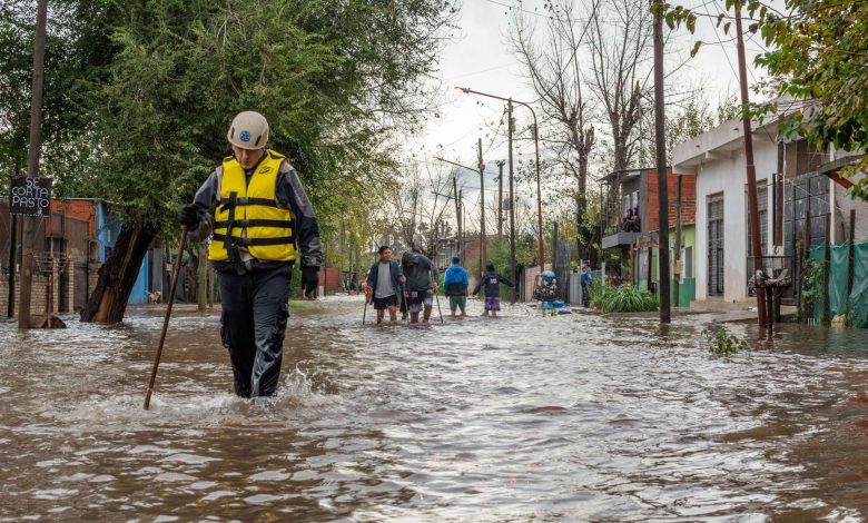
Flood zones are a starting point, not a force field.
For decades, flood risk was treated as a binary label: inside the zone or outside it. That approach worked when environmental conditions changed slowly and flood maps could keep pace with development patterns over time.
But change is not slow anymore.
Development, drainage, infrastructure conditions, and extreme rainfall are shifting flood behavior faster than many static models were designed to accommodate. As a result, more properties outside traditionally defined flood zones are experiencing repeated flood losses, exposing a widening gap between modeled risk and observed reality.
The National Oceanic and Atmospheric Administration (NOAA) continues to report rising frequency and severity of billion-dollar weather events across the United States, while research from the Federal Emergency Management Agency (FEMA) has highlighted limitations in legacy flood mapping frameworks as environmental conditions evolve more rapidly than historical update cycles were designed to handle.
This isn’t just a climate story or an insurance story anymore. It’s a data problem.
Organizations across insurance, government, logistics, utilities, real estate, and financial services are reevaluating how environmental intelligence is generated and maintained.
That is driving growing interest in AI-driven property intelligence systems that can monitor changes across the built environment more frequently and at greater scale.
In practice, this means combining high-frequency aerial imagery, computer vision, terrain analysis, and geospatial data pipelines to turn physical conditions into structured property-level signals that update over time.
From Static Maps to Living Environmental Models
Traditional flood maps still play an important role in risk management. But most were built around periodic update cycles. Survey the floodplain, update the model, revise classifications, repeat.
That framework becomes harder to maintain when conditions change between updates. Today, flood behavior is increasingly influenced by factors such as:
- Urban development and surface impermeability
- Aging or degraded drainage infrastructure
- Vegetation loss and land disturbance
- Extreme rainfall variability
- Terrain modification from construction and expansion
The impact of urbanization on runoff behavior and stormwater systems has been well documented by the Environmental Protection Agency, particularly as permeable landscapes are replaced by roads, rooftops, and dense infrastructure.
A newly developed commercial corridor, for example, may replace permeable land with roads, parking lots, and rooftops that increase runoff into nearby neighborhoods. A drainage system that once handled stormwater adequately may begin to fail under heavier rainfall or changing flow patterns. Yet those shifts may not appear in formal flood map updates for years.
That gap is where AI-driven geospatial intelligence is beginning to change the equation.
Rather than relying only on static geographic boundaries, modern property intelligence systems can combine aerial imagery, weather data, terrain models, infrastructure information, and machine learning analysis to build a more adaptive understanding of flood exposure at the property level.
The shift is not simply from manual assessment to automation. It is a move from static environmental models toward systems that update frequently enough to influence decisions, not just confirm conditions after the fact.
Why Property-Level Intelligence Matters
One of the biggest limitations of traditional environmental modeling is that risk is often generalized across broad geographic areas.
Properties are grouped into floodplains, ZIP codes, census tracts, or regional risk categories that may not reflect the conditions of any individual structure particularly well.
But flood behavior is highly localized.
Two properties on the same street can experience very different outcomes depending on elevation, drainage pathways, surrounding development, surface composition, and nearby infrastructure constraints.
Modern geospatial AI systems can analyze many of those variables simultaneously. For example, property intelligence platforms can identify signals such as:
- Micro-elevation changes
- Water flow pathways
- Retention and runoff behavior
- Drainage obstructions
- Surface material composition
- Roof geometry
- Vegetation density
- Nearby infrastructure constraints
- Historical pooling patterns
Individually, these signals may appear minor. Combined across large portfolios, they can provide a more detailed understanding of environmental exposure than static flood boundaries alone.
This does not eliminate the role of traditional flood mapping. It adds additional context that helps organizations understand where conditions may be shifting between formal updates.
The Infrastructure Behind Environmental Intelligence
What makes this shift possible is not just AI itself, but the convergence of several technologies that have matured at the same time:
- High-frequency aerial imagery
- Cloud-scale computing infrastructure
- Computer vision systems
- Geospatial analytics pipelines
- Large-scale data processing
Historically, geospatial analysis was limited by slow imagery refresh cycles, fragmented datasets, and computational constraints that made large-scale analysis difficult. Today, organizations can process much larger geospatial datasets more efficiently and compare imagery over time to identify changes that may influence flood behavior.
That includes changes such as:
- Newly developed impermeable surfaces
- Drainage degradation
- Vegetation removal
- Terrain modification
- Stormwater overflow behavior
- Post-event water accumulation patterns
Importantly, flood intelligence is fundamentally a temporal problem. Conditions evolve continuously, which means organizations need systems that can compare current observations against historical baselines and identify where risk may be changing.
But none of this removes the need for field work, inspections, or human expertise. It helps organizations prioritize where to look first.
Operationalizing Geospatial AI Across Disaster Response
One of the clearest applications for AI-driven property intelligence is post-disaster response.
After major flooding events, governments and emergency management agencies have historically relied on field inspections, delayed reporting, and fragmented situational awareness to understand the extent of damage. That process can take days or weeks.
High-frequency aerial imagery combined with geospatial analysis can help shorten that timeline significantly by giving agencies faster visibility into flooded transportation corridors, damaged structures, and heavily impacted areas.
This can improve early-stage decisions around emergency response, infrastructure repair, and resource deployment when time matters most.
For insurers and financial institutions, the same intelligence can help identify potential exposure concentrations across large property portfolios before traditional inspections are completed. The value is not simply speed, but faster prioritization.
This does not replace field work or adjusters. It helps organizations identify where teams should focus first.
The Operationalization Challenge
One reason many enterprise AI initiatives struggle is that building the model is often easier than integrating it into real operational workflows.
Environmental intelligence systems face that challenge directly.
Organizations must combine fragmented datasets with different formats, refresh intervals, quality standards, and levels of reliability. Imagery sources vary in timing and resolution. Infrastructure records may update infrequently. Hydrological models may operate separately from operational systems already used by insurers, utilities, or emergency management agencies.
Bringing fragmented datasets into usable workflows becomes a significant challenge.
Model interpretability is equally important.
As environmental intelligence begins influencing underwriting, infrastructure planning, emergency response prioritization, and financial exposure analysis, organizations need clear lineage, auditability, and explainability around how decisions are being informed.
The hard part is not the model. It is turning outputs into decisions inside systems people already trust.
The most effective implementations tend to integrate geospatial intelligence incrementally into existing workflows rather than attempting full system replacement.
Why Environmental Monitoring Is Changing
Traditionally, environmental risk assessment functioned as a periodic exercise. Organizations evaluated exposure annually, quarterly, or after major events. That model is shifting.
Organizations increasingly need visibility into changing conditions between formal assessment cycles, especially as weather volatility, infrastructure stress, and urban development create more dynamic operating environments.
In many ways, this mirrors shifts already seen in cybersecurity and infrastructure monitoring, where organizations rely less on periodic reporting and more on systems that surface operational changes earlier.
Environmental intelligence is beginning to evolve similarly.
Utilities can use geospatial AI to identify infrastructure vulnerabilities before severe weather occurs. Logistics operators can monitor flood-prone transportation corridors more closely. Real estate and financial organizations can reassess exposure across physical asset portfolios more frequently, while governments and emergency management agencies can improve early-stage disaster response planning.
Moving From Reactive Assessment to Adaptive Intelligence
Historically, many environmental risk decisions were reactive. Damage occurred first. Assessment followed later.
AI-driven property intelligence is helping organizations operate more proactively by identifying environmental changes earlier and updating exposure analysis more frequently.
That shift can support:
- Faster infrastructure prioritization
- More dynamic resource allocation
- Earlier identification of emerging vulnerabilities
- Improved emergency response coordination
- More responsive underwriting and exposure management
Importantly, these systems are not eliminating human decision-making. They are augmenting it with continuously refreshed observational intelligence that can scale across entire regions far faster than manual assessment processes alone.
The Future of Geospatial AI
AI-driven property intelligence is still evolving, but its value is becoming clearer as environmental conditions grow harder to model through static frameworks alone.
Organizations are operating in risk environments shaped by changing weather patterns, aging infrastructure, urban development, and shifting drainage behavior. As those conditions become more difficult to evaluate through periodic assessments alone, the need for more adaptive environmental intelligence will continue growing.
The next phase of geospatial AI is less about creating prettier maps and more about building systems that stay current enough to reflect changing conditions on the ground.
That has implications beyond flood modeling. Utilities, insurers, logistics providers, financial institutions, and emergency management agencies all depend on understanding how physical environments change over time and how those changes affect operational risk.
The win is not seeing more. It is making decisions that can keep up with reality.