I started Earth Ledger because the people making decisions about property and land are too often forced to act without the full picture.
The information may exist—across ownership records, planning systems, environmental observations, infrastructure networks, market data and local knowledge—but it is fragmented, difficult to interpret and constantly changing. No single source explains what is happening in a place, why it matters or what could be possible.
That gap has real consequences. Opportunities are missed. Risks emerge too late. Communities struggle to assess change. Landowners, businesses and governments make decisions without seeing how legal, environmental, social and economic factors connect.
Earth Ledger was created to close that gap.
We use AI not to replace the people who own, manage or care for land, but to give them a clearer, more complete and continually evolving understanding of it.
Because every parcel has its own history, rights, risks, responsibilities and opportunities.
That is why I believe every parcel of land needs its own AI.
Take one parcel: a residential house just outside of Seattle.
To its owners, it may be both a primary asset and a family home. To a real estate agent, it is a listing shaped by price, comparables and marketability. To a community, it is part of a shared landscape, connected to local livelihoods, infrastructure, water, safety, culture and a collective sense of place.
To a conservationist, it is land cover, habitat and terrain. To a fire-risk model, it is fuel, slope and exposure. To a utility, it is a point on the network – a source of demand, generation or potential flexibility. If it contains solar panels, storage, or electric vehicles, a virtual power plant (VPP) may see it as part of a wider, coordinated energy system.
To an AI engine, the parcel is a place-specific body of evidence assembled from records, observations, models and change over time. To an AI agent, it becomes something more: a persistent place to understand – one whose changing conditions can be monitored, whose risks and opportunities can be interpreted, and whose owners, stewards and communities can be better supported.
Each perspective reveals something important.
None reveals the whole place.
That gap, the distance between all the information that exists about land and the understanding available to the people making decisions, is why I started Earth Ledger.
The missing layer
Over the past two decades, I have worked across more than 20 countries on conservation, environmental finance and land stewardship projects, helping to manage more than $1 billion in conservation funding. Across different landscapes, institutions and economies, I kept returning to the same question: Why are some of the world’s most important decisions still being made without the full picture?
I realised we weren’t missing land, resources, or opportunities. We were missing connected intelligence.
Ownership records, planning rules, satellite imagery, infrastructure networks, climate models and biodiversity observations often existed. But they lived in different institutions, formats and timescales. The people responsible for a place could rarely see how those pieces related—or what had changed since the last decision.
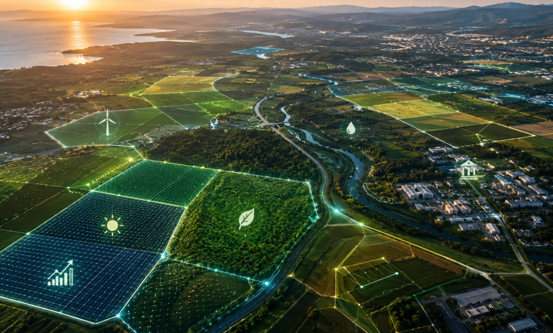
We were missing a layer of intelligence organised around the place itself – one capable of connecting its legal, ecological, social, historical, infrastructural, energy and economic dimensions; revealing different forms of value and utility for owners, communities, businesses, utilities, governments and nature; and translating parcel-level understanding into better decisions at local, regional and global scales.
An AI for every parcel
At Earth Ledger, we call that layer Parcel Intelligence.
A parcel AI is a permissioned and persistent, evolving intelligence profile for a specific property. It brings together trusted records, observations and models to explain current conditions, detect relevant change, explore possible futures and support human decisions – with its sources, uncertainty and permissions visible.
A general-purpose AI begins with a prompt. Earth Ledger AI begins with a place.
That difference matters because rights, responsibilities, hazards, eligibility and ecological relationships are not generic. They attach to particular locations, change over time and often depend on neighbouring places or connections. A decision about whether to install solar panels and battery storage is useful only when the system understands the parcel’s solar potential, energy demand, grid connection, planning constraints and economics, and can show how current and reliable that information is.
From static record to living context
Return to the property in Seattle. Its parcel intelligence could combine cadastral and planning records with roof geometry, solar exposure, shading, electricity demand, tariff structures, permitting
requirements and local grid capacity. With the owner’s permission, it could also incorporate smart-meter data, information about the electrical panel and the household’s priorities for cost savings, revenue generation, resilience and energy independence.
The system might identify where solar panels could be installed, estimate an appropriate system size and determine whether battery storage could improve self-consumption or provide useful backup power. It could flag potential rebates, tax credits and utility-bill offsets, distinguish indicative opportunities from confirmed eligibility, and identify whether the property’s distributed energy resources could participate in a virtual power plant bringing online new revenue opportunities.
At Earth Ledger, we describe those actions as Identify. Quantify. Connect.
Sometimes that process will reveal a development opportunity. Sometimes it will reveal a restoration priority, a legal constraint, a need for more evidence or a reason to leave a place undisturbed. Intelligence is valuable not because it always finds something to build, but because it helps people see where value is being created and how to connect it.
Better decisions for everyone connected to land
For landowners and stewards, parcel intelligence can make obligations, risks, incentives and options easier to understand. For communities, it can reveal cumulative effects across neighbouring parcels and create a clearer basis for scrutinising proposals. For governments, it can help target programmes and infrastructure while preserving due process and human review. For scientists and conservationists, it can connect observations to place, expose monitoring gaps and track ecological change.
Every parcel has different opportunities, constraints and responsibilities. That’s why every parcel needs its own AI.
A new way of seeing land
Navigation changed when maps stopped simply showing where things were and began helping us understand how to get there. Land is approaching a similar transition.
The goal is not to collect everything. It is to connect the right information, at the right level of permission, around the place where a decision will have consequences.
I believe every parcel will eventually carry an evolving intelligence profile. Understanding energy potential, infrastructure context, climate exposure, ecological condition and stewardship options could become as fundamental as knowing location or ownership.
That will require better data, responsible technology, trusted partnerships and decisions grounded in real-world expertise. It will require humility about what a model cannot know.
The future is not a machine deciding the fate of every piece of land. It is every parcel carrying enough trusted context for people supported by AI to make wiser decisions, and enough memory for those decisions to improve over time.
That’s what Parcel Intelligence makes possible.
And that’s why I believe every parcel of land needs its own AI.