If you’re building mapping applications, you’ll eventually encounter a familiar challenge. The feature set appears comprehensive. The interface is polished. The ecosystem integration feels seamless. Yet when users attempt to navigate a newly constructed road, directions fail. When a business updates its information, changes take days to propagate. When drivers take alternative routes, the system may not even recognize the road exists.
The problem is not the application layer. It is the data layer.
Having spent over a decade working on distributed geospatial data systems that process large-scale datasets across global regions, I have observed where mapping platforms succeed—and where they fail. The differentiator is rarely front-end sophistication. It is the integrity of the underlying data.
Most mapping projects don’t fail because the routing algorithms are flawed or the rendering engine is slow. They fail because the data feeding those systems is fragmented, stale, or inconsistent. It’s like building a high-performance engine and putting contaminated fuel in the tank.
The Freshness Problem
Here’s where most projects go wrong. They treat data updates as batch processes. Run an import once a week. Refresh the database overnight. Let the pipeline catch up when it can.
Map data doesn’t work that way.
A road closes. A business relocates. A landmark changes names. In rapidly developing areas, these changes happen daily. Yet most mapping systems operate on update cycles measured in weeks or months.
A recent industry analysis found that map data decays at a rate of approximately 15% annually. Roads change. Businesses close. Points of interest shift. Without continuous ingestion pipelines, maps drift further from reality with every passing month.
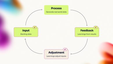
The fix isn’t better routing algorithms. It’s building ingestion systems that process updates in real time from multiple sources: government feeds, crowdsourced contributions, vehicle telemetry, and imagery analysis. Every source contributes a piece of the picture. The architecture must normalize, deduplicate, and reconcile these inputs without human intervention. Freshness is not a feature. It is an architectural choice.
The Consistency Challenge
Freshness alone is insufficient. Data must also be consistent across the millions of devices and services that depend on it. When a point of interest is updated in the central database, that change must propagate to navigation systems, search indexes, third-party APIs, and offline caches without creating conflicts.
This is harder than it sounds. A user in one region might see updated information while a user in another still sees stale data. A business owner who uploads new photos expects those images to appear immediately across all platforms. A developer integrating mapping APIs expects the same response regardless of which data center handles their request.
The naive approach is to replicate everything everywhere. But synchronous replication adds latency. Asynchronous replication risks serving stale data. The right solution requires designing a distributed platform with built-in replication, automated failover, and predictable latency under peak load. It also means separating the architecture into layers: a write-optimized ingestion tier, a validation tier, and a read-optimized distribution tier. Each layer has its own consistency requirements and its own trade-offs.
For critical navigation data, strong consistency is worth the latency. For photos and ratings, eventual consistency is acceptable as long as the propagation window stays under minutes. Understanding these trade-offs and designing for them from the start is the difference between a system that works and one that collapses under its own weight.
The Open Source Opportunity
One of the most effective ways to improve map data is also one of the most underutilized: open source contributions. There are open source platforms representing crowdsource geospatial datasets built by millions of contributors over nearly two decades.
Sourcing data from open databases can save millions of dollars compared to licensing from third-party vendors. More importantly, it enables coverage in regions where commercial data providers have limited presence.
The trade-off is data quality. Open source contributions vary in accuracy and completeness. Some regions are meticulously mapped by dedicated contributors. Others have significant gaps. Organizations using open data must build validation pipelines that assess quality region by region, applying automated checks and, where necessary, manual review.
When ingesting open-source water bodies, islands, and coastline data for nearly 160 countries, we faced this exact challenge. Many of these countries had limited map coverage, with significant landmarks like lakes, rivers, and islands either missing or inadequately represented. Some of these features hold cultural significance, making accurate representation essential. We could not simply import the data and hope it was correct. We built region-by-region analysis pipelines that cross-referenced open source contributions against satellite imagery, government sources, and local knowledge. We implemented geometry processing algorithms to handle complex 2D shapes, merge overlapping polygons, and resolve boundary disputes. For features that crossed national borders, we developed systems to respect sovereignty while maintaining map accuracy.
The result was enhanced coverage for millions of users. And because the data came from open sources, the cost was a fraction of what commercial licensing would have required.
The Validation Infrastructure
Data ingestion is only half the problem. The other half is validation. When multiple sources contribute to the same map, conflicts are inevitable. A government source may name a body of water one way. A local community may use another name. Satellite imagery may show a road that no longer exists on the ground.
Resolving these conflicts requires a validation infrastructure that sits upstream of the production database. This infrastructure must establish a canonical data model that defines how features are represented, including geometry, attributes, and relationships. It must implement geometry processing algorithms that can handle complex shapes and resolve disputes. It must automate quality checks for completeness, consistency, and compliance with local naming conventions. And it must provide human reviewers with tools to investigate edge cases where automated validation is insufficient.
For water bodies and islands that cross national borders, the challenge intensifies. Different countries may claim the same feature with different names. Territorial disputes require careful handling. The solution is not to avoid mapping these areas, but to build systems that can represent multiple perspectives while clearly indicating the status of each.
A large lake spanning three countries, each with its own official name, cannot show three names simultaneously without confusion. The solution requires extending the data model to support multiple name fields with language and region tags, allowing the application layer to display the appropriate name based on the user’s location and language settings. This is not a complex technical problem. But it requires the data model to be flexible enough to accommodate it from the start.
The Real-Time Requirement
Map users expect real-time responsiveness. When they search for a restaurant, results should appear instantly. When they request directions, the route should be calculated in seconds. When they upload a photo, it should be visible to other users within minutes.
Meeting these expectations requires a data pipeline designed for low latency. Batch processing is insufficient for real-time use cases. Organizations must build streaming architectures that process updates as they arrive, triggering downstream workflows automatically.
User-contributed content must flow through ingestion, validation, moderation, and distribution with minimal delay. A photo uploaded from a device must appear on the map within minutes, not days. Achieving this requires an architecture where every component is optimized for speed without sacrificing accuracy.
The infrastructure cost of real-time processing is substantial. But the cost of stale data is higher. Users who encounter outdated information lose trust. Businesses that cannot control their map presence lose customers. Organizations that fail to meet real-time expectations lose market share.
Decoupled ingestion pipelines that scale independently, in-memory processing for validation, and intelligent caching strategies that keep frequently accessed data hot while allowing less critical data to age out are the building blocks of a system that can deliver real-time responsiveness at scale. When implemented correctly, such systems deliver data faster while cutting operational costs significantly.
The Path Forward
All of these challenges are the same challenge. Organizations treat mapping as a UI problem when it is a data infrastructure problem. They invest in rendering engines and voice guidance while their data foundations crumble.
The freshness problem requires continuous ingestion pipelines, not batch imports. The consistency problem requires layered architectures that separate write from read. The open source opportunity requires validation infrastructure that ensures quality without sacrificing coverage. The validation challenge requires flexible data models that accommodate regional complexity. The real-time requirement requires streaming architectures that process updates as they arrive.
In 2026, the gap between mapping platforms is not measured by which has the most features. It is measured by which has the most reliable data. A March 2026 analysis confirmed that users continue to choose mapping applications based on accuracy, real-time intelligence, and global consistency, not on UI polish . The platforms that win will be those that treat data as the product.
The organizations that succeed in the next decade will be those that invest in the foundations before chasing the next feature. They will build continuous ingestion pipelines that process updates in real time. They will design validation frameworks that ensure quality without sacrificing speed. They will contribute to open source ecosystems while maintaining rigorous standards. They will architect for consistency without compromising latency.
All of this is possible. It requires architectural discipline, cross-team coordination, and a willingness to do the unglamorous work that never appears in press releases. But the alternative is a map that users cannot trust. And in navigation, trust is everything.