The technological revolution is becoming a powerful ally in ocean conservation and the sustainable use of marine resources through satellite data and the growing willingness of many countries to share fishing fleet tracking information.
SAN JOSÉ , Costa Rica, July 13, 2026 /PRNewswire/ — The Eastern Tropical Pacific (ETP) has emerged as an international model of cooperation among countries such as Costa Rica, Ecuador, Panama, and Colombia, which are linked by a marine corridor featuring natural treasures such as Cocos Island, the Galápagos Islands, Coiba Island, and Malpelo Island. The corridor provides a sanctuary for numerous shared species and has made fishing activity visible in areas where it was once virtually impossible to monitor.
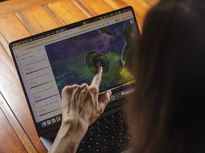
The international organization Global Fishing Watch operates a platform that compiles publicly available satellite data and information shared by several countries to create a large map showing the near real-time locations of fishing fleets. The platform enables analysis, identifies patterns, detects risks, and supports concrete marine conservation efforts.
“With the technological revolution, the help of satellites, and the monitoring devices vessels carry to prevent collisions at sea, we can understand what is happening out there. We have eyes at sea.” Global Fishing Watch’s Head of Latin America, Global Programs, Mónica Espinoza, told EFE.
The platform relies on Automatic Identification System (AIS) data, which commercial vessels use to avoid collisions, as well as Vessel Monitoring System (VMS) data held by government authorities, and satellite imagery.
“It is not just about understanding where vessels are or where human activity is taking place, but also about understanding how this relates to sea temperatures, especially with a strong El Niño event approaching, how those interactions may affect human activity and species migration patterns,” Espinoza said.
These “eyes at sea” also contribute to the creation and management of protected marine areas and help ensure they achieve the greatest possible impact. One example is the expansion of the protected area surrounding Costa Rica’s Cocos Island, where satellite tracking technology showed that fishing activity has declined by 98% in recent years.
Carlos Chacón, Global Fishing Watch’s Senior Manager for Latin America, said that understanding what is happening in the oceans is essential for the sustainable management of marine resources and keeping them healthy. One of the organization’s goals, he said, is to work with governments and other stakeholders to provide that information.
Media contact
Nancy de Lemos
Communications manager, Latin America
+506 8831-0236
[email protected]
 View original content to download multimedia:https://www.prnewswire.com/news-releases/satellite-technology-becomes-eyes-at-sea-helping-protect-latin-americas-oceans-302824032.html
SOURCE Global Fishing Watch