
A Mechanism for Survival
During my time at Google, working alongside the teams that would later merge into DeepMind, I witnessed firsthand the staggering pace of artificial intelligence. We were building systems capable of processing vast amounts of language and abstract data. Yet, despite this progress, a critical blind spot remained: these models were fundamentally disconnected from the physical world. They could predict the next word in a sentence, but they could not construct a dynamic representation of human infrastructure or simulate how cities and buildings evolve.
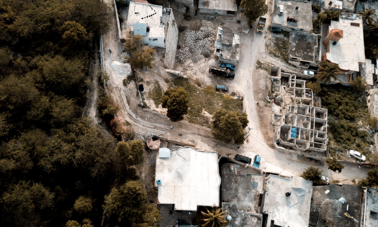
For me, addressing this gap wasn’t just a technical challenge—it was personal. Growing up in Haiti, I witnessed the devastating 2010 earthquake that obliterated Port-au-Prince’s infrastructure in a matter of seconds. In the years following the disaster, recovery efforts relied on static aerial imagery to reconstruct what was lost. The inability to fully understand and simulate the physical environment impeded recovery.
That experience planted a seed. It drove my work for the next decade and led to a technology that has the potential to completely transform our understanding of the built world: spatial intelligence.
Spatial Intelligence: The Next Frontier in Global Real Estate
For decades, real estate has been evaluated through static data: comparable transactions, occupancy figures, and cap rates. Due diligence is performed to understand capital requirements and deferred maintenance. These metrics matter. However, they share a crucial flaw: they represent merely a moment in time.
These evaluations miss a significant and often expensive point: the built environment cannot be evaluated merely by what has occurred in the past. Instead, it needs to be assessed based on how structures perform under stress, adapt over time, and continually serve the people inside them. Traditional property data focuses on financial history. Market analytics track fluctuations in price. Yet neither captures physical reality in a dynamic world.
Spatial intelligence is the ability to reason about the physical world as it exists and evolves across space and time. It captures what a building can withstand and how it responds to disruption and environmental stress. More importantly, it reveals how a property changes as the world around it changes—at both the macro and micro level it inhabits.
The Gap — And What It Has Cost the Built World
For too long, commercial real estate has understood buildings without properly modelling their future state. The consequences of this blind spot are concrete: assets are mispriced, underwriting assumptions are incomplete, and tenants occupy spaces exposed to risks that were never fully assessed.
Spatial intelligence is a rapidly maturing industry, with the global market projected to reach $62.9 billion by 2030, growing at an 11% CAGR. Real estate and construction are explicit verticals in driving this growth. Despite this, there is a strikingly fragmented approach in the adoption of spatial intelligence in commercial real estate. For example, the majority of real estate professionals rely heavily on siloed spatial data to assess a building. According to SafeGraph, commercial real estate managers can spend up to 80% of their time farming data; collecting data has become a core, structural inefficiency.
More critically, the data they have access to is mired in the past.
Where Spatial Technology Meets the Built World
Closing this gap requires tools that are accessible, operational, and scalable.
Today, a new type of AI model— known as a world model—enables spatial intelligence at scale by simulating real-world actions to predict how buildings evolve. Allowing us to uncover hidden risks and opportunities. What once required weeks of ground surveys and fragmented datasets can now be accomplished in seconds, producing a living example of the built world.
At the portfolio level, spatial intelligence integrates imagery, environmental data, and structural indicators to produce actionable risk profiles.
To go back to Haiti, there is a profound difference between knowing a region is earthquake-prone and identifying which specific blocks—even which specific structures—are most exposed to seismic shock.
The level of precision enabled by spatial intelligence transforms risk into a key property strategy. It creates opportunities and generates additional revenue. It may even save lives.
From Competitive Edge to Market Standard
The implications of spatial intelligence have different consequences depending on where you sit.
For commercial real estate, spatial intelligence offers competitive advantages: better underwriting capabilities and more supportive capital allocation. Importantly, spatial intelligence reframes risk as opportunity.
As cities grow faster than the systems designed to map and monitor them, the information gap widens. Yet the technology needed to close that gap already exists. The real question is whether commercial and financial institutions choose to recognize spatial intelligence not simply as a competitive advantage but as fundamental to a city’s endurance.
The built world has always been dynamic; our understanding of it has not. For too long, abstractions and historical data have been used to understand and manage physical risk, as well as opportunity. In the places where the gap is the most costly, and in the markets where it remains invisible, closing it is no longer optional. It is fundamental.