From emergency officials to utility providers and retailers, organizations are increasingly seeking real-time visibility into predicted flood impacts as storms become faster, more disruptive, and harder to predict.
DENVER, May 14, 2026 /PRNewswire/ — As hurricane season approaches, organizations across the United States are facing a growing challenge: understanding how flooding will impact operations, infrastructure, transportation networks, and communities in real time.

Despite decades of investment in floodplain mapping, weather forecasting, and disaster planning, many agencies and businesses still struggle to answer critical operational questions before and during major storm events:
Which communities need to be evacuated? Which roads are becoming impassable? Which facilities are at risk? Which communities may lose access to critical services? Where should crews and resources be deployed first?
The challenge has become increasingly urgent as extreme rainfall events grow more intense, more localized, and more difficult to predict.
In July 2025, catastrophic flooding across Central Texas escalated rapidly overnight, overwhelming roads and low-lying areas across multiple counties. Similar disasters in recent years across the eastern United States have exposed how quickly flood conditions can outpace traditional planning tools and static flood maps.
In response, a growing number of emergency management agencies, utilities, transportation departments, and major retailers are beginning to adopt impact-based flood forecasting and real-time flood impact monitoring tools designed to provide earlier visibility and support operational emergency preparedness and response workflows as storms unfold.
“These events are evolving faster than many traditional systems were designed for,” said Juliette Murphy, FloodMapp CEO and co-founder. “Flood hazard maps are essential for understanding long-term risk, but organizations also need operational visibility during an event. That’s where many preparedness and business continuity gaps still exist. Timely, impact-based forecasting and situational awareness help agencies and businesses understand what is happening on the ground, who and what may be affected, and where conditions are likely to worsen—enabling faster, more coordinated response decisions when time matters most.”
FloodMapp, and Australian-founded flood forecasting company with operations in the United States, has supported flood preparedness and response initiatives for governments and commercial organizations in both the U.S. and Australia.
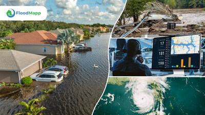
During the 2025 Texas floods, FloodMapp’s live flood monitoring tools were deployed mid-crisis to support statewide response efforts, helping agencies visualize changing flood conditions and understand the impacts to roads, buildings, and communities.
In Virginia’s Blue Ridge region, FloodMapp is currently supporting a regional flood resilience initiative—made possible by RISE Resilience Innovations, with funding from the Virginia Department of Housing and Community Development—to improve flood preparedness and early warning capabilities for mountain communities vulnerable to fast-rising flash floods.
Commercial organizations are also increasingly incorporating flood intelligence into continuity planning and operational decision-making. Major retailers, utilities, and logistics operators are placing greater emphasis on understanding site-level flood impacts in advance to help protect employees and inventory, maintain access to facilities, reduce downtime, and support community operations during severe weather.
In Queensland, Australia, and Norfolk, Virginia, flood intelligence is being integrated into navigation platforms such as Waze and Google Maps to help warn drivers about flooded roads and dangerous travel conditions, redirecting them to safer routes.
According to the U.S. National Weather Service, flooding remains one of the leading causes of weather-related fatalities in the United States, with many deaths occurring in vehicles when drivers attempt to cross flooded roads.
Risk communication researchers such as Dr. Jeannette Sutton, owner and founder at The Warn Room, have emphasized the importance of timely, location-specific, and actionable warnings during disasters—particularly during rapidly evolving events where delays or unclear messaging can put lives at risk.
As another hurricane season begins, the ability to see flood impacts in real time is quickly becoming essential to public safety, business continuity, and emergency response.
About FloodMapp
FloodMapp provides operational, impact-based flood forecasting and real-time impact intelligence to support preparation, response, and recovery. Updated hourly and delivered into existing GIS and operations systems, FloodMapp maps flood extent, depth, and impacts to the built environment.
To request a short demonstration, contact [email protected]. FloodMapp is headquartered in Brisbane, Australia, with a U.S. hub in Denver, Colorado. Learn more at www.floodmapp.com
![]()
![]() View original content to download multimedia:https://www.prnewswire.com/news-releases/as-hurricane-season-nears-communities-are-reassessing-how-they-prepare-for-floods-302772741.html
View original content to download multimedia:https://www.prnewswire.com/news-releases/as-hurricane-season-nears-communities-are-reassessing-how-they-prepare-for-floods-302772741.html
SOURCE FloodMapp