Using artificial intelligence, Jan Dirk Wegner and the EcoVision lab opens up a channel for exploration of the different aspects of the Earth’s surface using AI.
Jan Dirk Wegner founded the EcoVision lab at ETH Zurich three years ago with a mission to protect biodiversity and improve on the quality of life for all people.
Along with the rest of his team at the EcoVision lab, Wegner works toward solving ecological obstacles through the use of computer vision and remote sensing.
Examining environmental data through innovative machine learning and data analysis, the team combines this with environmental science to tackle questions of biodiversity in order to improve on the lives of people.
Gathering information for AI analysis
Artificial intelligence is at the base of what Wegner claims to be the source of computer-generated maps of the world. These maps are different to what we would ordinarily imagine as they have been automated to display parameters such as deforestation or biodiversity.
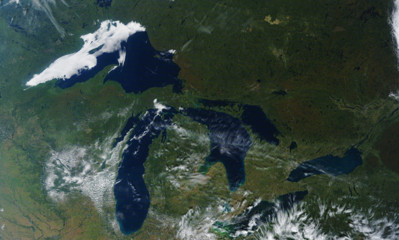
This information is gathered through a variety of different means ranging from photogrammetry, detecting and monitoring the physical elements of an area, and even satellite imagery. The team uses satellite imagery from Sentinel-2 which collects optical imagery at high spatial resolution covering land and coastal water.
Once imagery and data have been collected through such resources, the data sets are analysed and decoded by artificial intelligence. Offering information that can be used to improve global environmental issues, such as farming.
Using AI to better the environment
Advances in artificial intelligence techniques put toward the face of environmentalism and ecology have been outstanding.
“I’m aware that at first glance, artificial intelligence doesn’t seem to have much to do with the environment, but this combination truly has great potential,” Wegner said in a recent interview.
AI is already being used to tackle issues such as climate change through allocating renewable energy and strengthening climate predictions. It’s used to
The EcoVision lab is part of the ETH initiative of ETH4D (ETH for development. The program develops models that address global challenges such as those faced by the environment.
ETH4D is set with the belief that harnessing the innovation of projects aimed towards sustainable development will offer support and progression to those in poverty.
Technological advancements and AI can help to resolve the challenges poor people struggle with such as functional and sustainable housing, health, water, nutrition and energy.
Wegner and his team at the Eco Vision lab have collaborated with a Zurich based chocolate producer to not only reduce deforestation but to provide buyers with legal and sustainably encouraged places to purchase Cocoa Beans. The software they have developed uses satellite imagery to pinpoint where cocoa is being farmed illegally.
This then allows for producers to ethically source their beans and further provides people in developing countries with access to the software, allowing for a new scope of data.
EcoVision lab software
Jan Dirk Wegner and his team made available the EcoVision labs software, for free use and download on public platforms, anywhere around the world.
This decision was made in order to branch out in the collection of data, as the team knew it would be limited whilst accessed only from their lab in Zurich.
Wegner has now been made a member of the World Economic forum’s young scientist community, which is a huge honor.
It’s safe to say that the work centred around AI and environmentalism are heading along the right tracks, with projects such as from the EcoVision lab.


One Comment