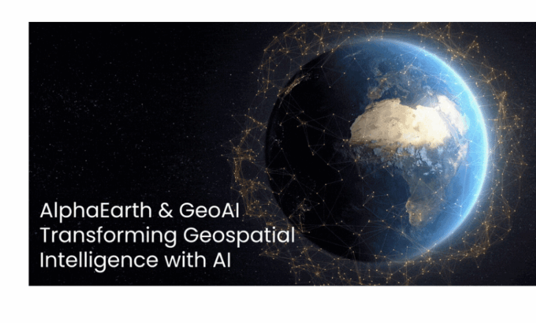
Google Geospatial AI has advanced with the launch of two new AI frameworks, AlphaEarth and Geospatial Reasoning, allowing users to ask detailed, real-world questions about specific locations. AlphaEarth by Google is a geospatial foundation model that generates a time-continuous, universal embedding field for the entire planet. Fusing petabytes of multimodal data—optical imagery, radar (SAR), LiDAR, climate records, and geotagged text—into a compact 64-byte, 10-meter-resolution representation delivers a rich, high-precision digital view of Earth. It supports real-time environmental analysis using satellite images, natural language, and Google Earth tools. AEF was trained using a teacher–student paradigm over a dataset comprising more than 3 billion observation frames (i.e., video sequences), collected from over 5 million geolocated sites globally (covering ~1.1% of Earth’s land area.
This marks a new era of advancement by Google, Geospatial is taking the shape of geospatial artificial intelligence (GeoAI) by supercharging all the data using artificial intelligence. It works with geospatial data, such as satellite images, maps, and GPS coordinates, and is built ground-up with AI technologies such as computer vision, deep learning, and machine learning. From forecasting climate changes to optimizing urban planning, geospatial AI redefines industries, relying on satellite imagery, maps, and GPS data.
It seems interesting, right? Let’s explore how Google’s geospatial model, Alpha Earth, redefines how we assess and use location-based data, observe and predict Earth’s systems, impact GeoAI, why it matters, the changes it brings, and much more.
GeoAI delivers
- Updating outdated geospatial information and automating map-making.
- Refining decision-making in agriculture, urban planning, and disaster management.
- Identifying patterns in the environment and geographic changes.
- Processing large amounts of satellite images in real-time.
AI-powered algorithms help GeoAI turn raw spatial data into actionable insights, supporting industries in making data-oriented and smarter decisions.
AlphaEarth: DeepMind’s Breakthrough in Geospatial AI
Google geospatial AI started a new phase by introducing two key models in June and July 2025. Geospatial Reasoning, powered by DeepMind’s AlphaEarth and Gemini 2.5, uses satellite images, natural language, and Google Earth tools to support real-time environment analysis. In 2025, Google’s geospatial AI is set to transform how we observe and map the Earth. Powered by Gemini 2.5 and DeepMind’s AlphaEarth, the new “Geospatial Reasoning” model functions as a virtual satellite, offering advanced Earth monitoring capabilities. Designed to assist governments, researchers, and urban planners, it allows faster, more accurate responses to climate change, infrastructure mapping, and natural disasters, all while optimizing data storage efficiency.
In a model like AlphaEarth, data annotation companies play a foundational role by labeling massive volumes of aerial and satellite imagery to identify features such as vegetation, rivers, roads, disaster zones, infrastructure, and climate impact areas. Their work determines that the AI can accurately classify, detect, and track geographic changes. By integrating human-in-the-loop feedback, annotation teams support aligning the system’s interpretations with professional judgment, especially for nuanced tasks like environmental monitoring or damage assessment.
What it Offers
It interprets and responds to complex spatial queries.
Example queries include:
- “Which neighborhoods in NY are most vulnerable to heatwaves?”
- “Where has new construction appeared in the past six months?”
It offers valuable insights for:
- Urban planning
- Disaster management
- Environmental monitoring
From Data Overload to Unified Planetary Intelligence
Earth observation has faced a significant paradox for years: while satellites provide near-real-time imagery, the vast and fragmented data make it hard to extract meaningful insights. Google DeepMind’s AlphaEarth Foundations addresses this by acting as a “virtual satellite”—fusing massive, diverse datasets into a single, coherent digital representation of Earth.
Instead of analyzing satellite images in isolation, AlphaEarth integrates optical, thermal, radar, and 3D mapping data from satellites like Sentinel-2 and Landsat and climate simulations. This unified model enables accurate monitoring of terrestrial and coastal regions, helping researchers and policymakers make smarter decisions on food security, urban growth, deforestation, and water management.
How AlphaEarth Foundations Works and the Role of Data Annotation?
AlphaEarth Foundations offers a transformative approach to comprehending Earth by tackling two key problems: data overload and fragmented information.
1. Integration of Diverse Geospatial Data
AlphaEarth brings massive volumes of public data such as optical satellite imagery, radar, 3D laser scans (LiDAR), and climate simulations. It evaluates land and coastal regions at a fine resolution of 10×10 meter squares, enabling precise tracking of environmental and human-induced changes over time.
2. Efficient Summarization and Storage
A standout feature of AlphaEarth is its ability to generate compact summaries of each square, reducing storage needs by up to 16x compared to previous AI systems. This drastically lowers the cost of large-scale geospatial analysis and makes high-frequency monitoring more accessible.
3. On-Demand Planetary Mapping
With these efficiencies, AlphaEarth empowers scientists, governments, and organizations to create detailed, consistent, on-demand maps for applications like crop monitoring, urban development, disaster response, and deforestation tracking without waiting for satellite passes.
The Role of Data Annotation in AlphaEarth
Behind AlphaEarth’s intelligence lies a critical foundation: high-quality data annotation
Data Sourcing & Ingestion
- Raw data types, such as satellite imagery (multi-spectral, radar), aerial/drone imagery, street-view data, LiDAR point clouds, GIS layers, and text-based geospatial metadata, are collected.
- Data pipelines pull feeds from providers such as Sentinel, Maxar, Landsat, Planet, and government open-data portals.
- Metadata alignment determines that imagery is tagged with georeferencing details (latitude, longitude, time, sensor type).
Preprocessing for Labeling
- Preprocessing begins with tiling by breaking massive satellite images into manageable, smaller patches.
- Next steps are normalization and cloud/shadow masking. Experts remove noise from weather effects before labeling.
Annotation Workflows
- Specialized geospatial labeling tools like CVAT, Labelbox, and ArcGIS AI are used for tasks such as object detection (buildings, roads, vehicles, ships), semantic segmentation (land cover, vegetation, water bodies), change detection (deforestation, construction, flooding), and 3D point cloud labeling for LiDAR and elevation data.
- Automated pre-labeling with weak AI models provides initial annotations that humans refine, increasing labeling speed by up to 400%.
Quality Assurance with Domain Experts
Domain experts such as cartographers, GIS specialists, environmental scientists, etc., are involved for such specialized tasks.
To ensure quality with multi-pass review, each project has at least two independent annotators plus a senior reviewer.
Data Management & Security
Secure cloud environments that ISO 27001 / SOC 2 certified; access control via VPN and RBAC (role-based access control).
Continuous Model Feedback
- Labeling companies run iterative annotation cycles as AlphaEarth or similar models are trained and deployed.
- Identify model weaknesses (false positives/negatives) in specific geographies or feature types.
- Feed corrected and edge-case data back into the training loop.
Support active learning—where the model flags uncertain areas for human labeling.
Industrial Benefits it Brings
GeoAI is redefining industries by amalgamating geographical data with AI and machine learning to make predictions, exhibit patterns, and drive smarter decision-making. It is transforming the following sectors:-
1. Precision Farming
By trying and testing Google’s geospatial model Alpha Earth, there are visible benefits, such as using data to comprehend agricultural and environmental changes, better classify unmapped ecosystems, and improve the speed and accuracy of mapping work. It seems promising to turn farming into high-tech. AI-oriented analysis enables farmers to:-
- Detect water shortage and drought conditions.
- Minimize resource waste and optimize irrigation methods.
- Monitor crops with the help of satellite images.
- Highlight pest infestations before they appear as a problem.
Using AlphaEarth’s compact 10×10 meter summaries, urban planners in rapidly growing cities like Lagos, Nigeria, can track infrastructure development weekly instead of relying on monthly or quarterly satellite passes.
For instance, when monitoring the expansion of informal settlements or encroachments into protected wetlands, AlphaEarth processes and summarizes satellite, radar, and elevation data to highlight newly constructed rooftops or land-use changes.
Thanks to its 16x smaller storage footprint, local authorities can access high-resolution change maps over large urban areas without needing expensive data infrastructure, enabling faster zoning decisions, better resource allocation, and timely interventions.
2. Disaster Management and Emergency Response
Artificial Intelligence plays a crucial role in emergency response and disaster management strategies. In the face of natural calamities such as earthquakes, wildfires, and hurricanes, accurate geospatial data remains a key factor in timely action. AI, with the help of sensor data and satellite imagery, identifies impacted areas and predicts disaster progression.
For instance, in wildfires, AI systems assess factors like vegetation density, wind patterns, and terrain to forecast fire spread, enabling firefighting teams to use resources more efficiently. Similarly, AI-powered GIS tools gauge river levels, rainfall, and elevation data during floods to foretell high-risk zones and support issuing early warnings.
GeoAI works as an emergency responder during natural disasters. It acts smarter and faster by evaluating real-time drone and satellite imagery. It works in the following ways:-
- It supports government and relief agencies to optimize funding, prioritize aid distribution, and plan reconstruction effectively.
- AI allows faster and more informed decision-making that decreases harm and accelerates recovery in disaster situations.
- AI can scan damaged areas after earthquakes to identify the hardest-affected regions for faster rescue operations.
- Machine learning systems can foresee fire spread patterns during wildfires, enabling authorities to act proactively.
- By analyzing historical data in flood-exposed areas, AI shares warnings in advance, reduces damage, and saves lives.
The emergence of AI environmental disaster prediction—exemplified by DeepMind’s AlphaEarth—represents a paradigm shift in climate risk management. By translating environmental data into early alerts and impact modeling, this technology enhances readiness, resilience, and equity.
As AI tools integrate further into environmental governance, the focus must remain on transparency, human-centered design, and global access. AlphaEarth and its successors appear instrumental in safeguarding communities as climate threats escalate.
3. Urban Planning & Smart Cities
The future of city construction is being shaped by AI-assisted GIS technology. City governments and urban planners utilize geospatial data to design & build infrastructure, optimize transportation networks, and enhance civic services. Artificial intelligence supports these efforts to the next stage by offering real-time insights into traffic patterns, population movement, and land use patterns.
For instance, AI-assisted GIS software can evaluate road congestion to forecast peak travel times, optimize traffic light synchronization, and provide alternative routes. It can help limit environmental pollution, lower fuel consumption, and reduce commute time. AI algorithms can also support site selection for new commercial and residential developments based on economic feasibility, environmental sustainability, and accessibility.
In smart city applications, AI-guided GIS solutions provide real-time city infrastructure monitoring. Geospatial analytics and IoT sensors unite to predict infrastructure failure, track energy consumption, and streamline waste management. Thus, cities are becoming more sustainable, responsive, and habitable with the ability of AI to evaluate and process geospatial data at scale.
4. Climate Change Analysis and Environmental Sustainability
AI systems can predict rising sea levels, vegetation shifts, glacial melt rates, etc. These insights are indispensable for building effective climate adaptation strategies and sustainable development policies. GeoAI also predicts extreme weather conditions and evaluates water & air pollution in both urban and rural setups. With its predictive capabilities, it helps organizations and governments to mitigate potential risks before they result in full-scale crises.
Solar and wind energy service providers apply AI-driven geospatial analysis to identify optimal locations for solar panel and wind farm installations, assessing factors such as wind velocity, sunlight exposure, and terrain suitability.
GeoAI is safeguarding the planet and powering a resilient and greener future by redefining how we comprehend and respond to environmental challenges.
5. National & Defense Security
AI-powered surveillance systems can identify unusual activities near borders or critical infrastructure, enhancing national security without heavily relying on human monitoring.
Real-Time Surveillance
AlphaEarth can unify radar, satellite, and 3D mapping data to monitor military zones, borders, and military and strategic assets in near real time.
Precision Threat Detection
Its 10x10m resolution detects unusual activities early, such as infrastructure changes and troop builds, even in remote and cloud-covered areas.
Faster Intelligence Processing
Compact data summaries (16x smaller) allow quicker analysis and decision-making during critical operations.
Predictive Insights
By tracking patterns over time, AlphaEarth can anticipate potential conflicts or threats.
Reduced Human Effort
Automates image analysis to free up defense analysts for higher-level strategic response.
In a Nutshell
Thus, the new launch by Google marks a significant leap in Earth observation by providing an AI-powered, scalable framework to monitor planetary changes more efficiently and accurately. Associated with time-based insights, it also opens up new possibilities for handling significant global challenges in agriculture, climate resilience, disaster response, and urban planning. This innovation has also brought the demand for data annotation along with it. The annotation service provider’s role remains critical to meticulously label aerial, geospatial, and satellite imagery to ensure AI systems like AlphaEarth can distinguish patterns over time, validate ground truths, and improve prediction accuracy across dynamic geographies.