When you look at Earth from space, what you’re really seeing is a planet in constant motion: coastlines shifting, forests thinning, cities growing. And while satellites have been capturing this movement for decades, what’s changed is our ability to actually understand it. With artificial intelligence entering the picture, those millions of data points coming in from space each day are no longer just images. They are now answers to urgent questions about our climate, food supply, and safety.
The Power of Live Satellite Images
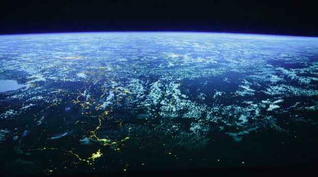
Until recently, most satellite data was used in hindsight. You could look back at a storm, a fire, or a harvest and analyze what happened. But today, that timeline has changed. With better sensors and faster transmission, we now have access to live satellite images that reflect what’s happening on Earth almost as it unfolds. This is especially important for areas where time matters most, like floods, wildfires, or crop failures, to name a few.
However, the data volume is staggering. A single satellite can produce terabytes of imagery every day. Multiply that by hundreds of satellites, and it’s more than any human team could possibly review. That’s where AI steps in not to replace the human eye, but to narrow it. It’s not just looking for changes on the surface, but learning how to detect patterns, prioritize threats, and even forecast what may come next.
But even though satellite data providers and their capabilities advance, some legacy platforms may no longer be an option. Sentinel Hub’s EO Browser, once valued for quick access to open data, now requires user login and supports fewer datasets, pushing many to seek faster, more flexible alternatives. EOSDA LandViewer answers that need with free access, a broad satellite archive, and advanced analytics tools, making it a powerful solution for deeper Earth monitoring.
How AI Processes Satellite Data
AI systems start with training. Engineers feed models tens of thousands of labeled images of forests, cities, clouds, roads, floods and teach them to recognize what’s what. Over time, the algorithms become more accurate, even in difficult conditions like heavy cloud cover or nighttime imagery.
Once trained, these systems can process recent satellite images in minutes. They don’t just highlight where something has changed but also try to understand why. For example, if vegetation cover suddenly drops in an agricultural region, AI tools can compare rainfall records, temperature anomalies, and historical crop cycles to offer a likely explanation.
NASA is increasingly applying artificial intelligence and machine learning techniques to process vast amounts of Earth observation data. These AI tools help accelerate data analysis and improve understanding of dynamic Earth systems across diverse fields.
What makes AI so powerful in this field is its speed. During fast-moving events like hurricanes or wildfires, satellite data alone isn’t fast enough unless someone or something can analyze it immediately.
Real-World Applications
While the technical capabilities of AI and satellite technology are impressive, their real value lies in how they’re applied. From tracking forest loss to helping farmers protect their crops, these tools are already making a tangible difference.
Environmental Monitoring
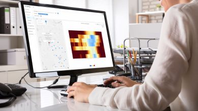
With AI analyzing current satellite imagery, researchers can track melting glaciers, deforestation, and shifts in vegetation health over time. Instead of relying on manual comparisons, they now receive automated alerts when something in the landscape changes significantly. This helps conservation teams respond faster, but it also offers a more complete picture of how ecosystems are evolving.
Disaster Response and Risk Assessment
After an earthquake or a flood, getting accurate information quickly is often the difference between an effective response and a delayed one. AI systems now compare the most recent satellite images with older imagery to instantly highlight which roads are blocked, which buildings are damaged, and which areas are hardest hit.
This same technology also helps assess risk before disaster strikes. In wildfire-prone regions, for instance, AI can analyze heat signatures and vegetation dryness to predict areas of concern. That way, responders aren’t just reacting — they’re preparing in advance.
Agriculture and Food Security
Farmers and food agencies are using AI-driven satellite data to improve how we grow and manage food. From monitoring crop growth to detecting pest outbreaks, the combination of satellite views and AI models means fewer surprises during the growing season. AI can flag unexpected changes in plant health or soil moisture using live satellite view data, giving farmers time to adapt and reduce losses.
At a national level, this information feeds into food supply planning. If drought is beginning to affect yields in one part of the world, governments and NGOs can take early steps to mitigate the impact. For countries facing food insecurity, this type of forecasting can be life-saving.
Urban Planning and Infrastructure
Although cities aren’t built in a day, they are growing faster than ever. Planners need to keep up with expansion, manage traffic, monitor pollution, and make sure infrastructure keeps pace. Satellite data provides the visual foundation, and AI fills in the context. It can track new construction, identify gaps in public services, or monitor urban heat islands that pose health risks.
This tech is also being used to update outdated maps, particularly in rapidly changing urban zones. Instead of sending out survey teams, cities now use AI to analyze satellite imagery and automatically detect new roads, buildings, and other infrastructure changes. The result is more adaptive, data-driven planning.
As we face more pressure from climate change, resource scarcity, and population growth, AI’s ability to make sense of space-based data becomes a vital asset.
Author:
Kateryna Sergieieva has a Ph.D. in information technologies and 15 years of experience in remote sensing. She is a scientist responsible for developing technologies for satellite monitoring and surface feature change detection. Kateryna is an author of over 60 scientific publications.